Grading
Understanding grading is a crucial concept to embrace before design or construction begin on a site. This example below drains water away from the town homes by using grass bio-swales that are at a lower elevation than the finished floor elevation (F.F.E.) of the town homes and begins at the high point of swale (234.2').

Master Grading
This grading project was done on a community master plan I designed. Our class graded this site at three different scales: 1"=100', 1"=50', and 1"=20'. All major contours have a darker line weight and occur at intervals of ten feet. The main objective of grading around a highly residential area is to get the water to drain away from the foundation, so I drew many bio-swales of lower elevations than the buildings finished floor elevation. The plan below is 1"=50' and the following plan is 1"=20'.


Cut and Fill
Grading and calculating cut and fill saves a considerable amount of time when using computer programs such as Microstation, as opposed to doing it the traditional way by hand. Little clean up is required to connect proposed to existing contours to make the plan read well.

Road Alignment
Horizontal road alignment and vertical profiles can be drafted and computed much quicker with Microstation, than traditional hand drafting.

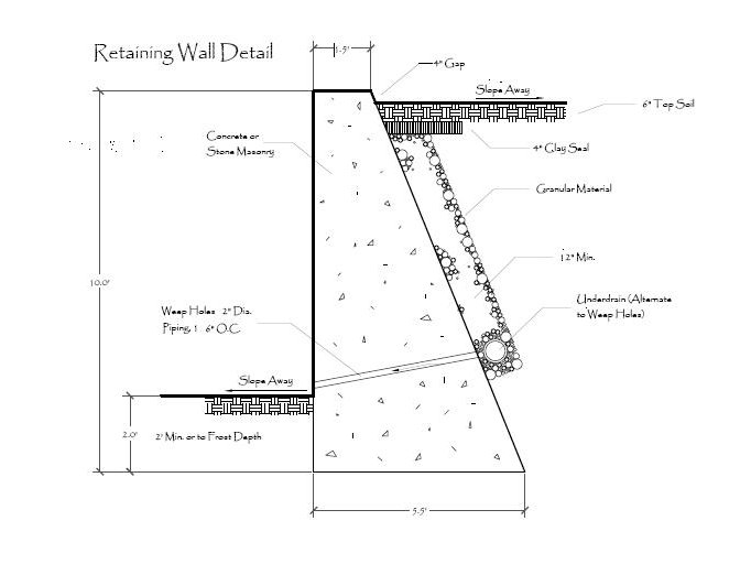
Construction Details
B&B Tree Specifications

Shrub Specifications
